Browse categories
Explore
Fiverr Pro
English
$
USD

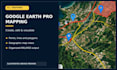
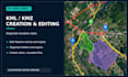
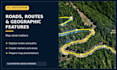

I will create, edit and visualize geographic data using Google Earth Pro.
I am an experienced Transport and Traffic Engineer with 20+ years of professional experience in road infrastructure, mapping and spatial data management.
MY SERVICES INCLUDE:
PACKAGES:
BASIC ($75): Up to 20 simple features, 1 map.
STANDARD ($150): Up to 60 simple features, 2 maps.
PREMIUM ($300): Up to 150 simple features, 3 maps.
Deliverables include KML/KMZ files and agreed map views.
IMPORTANT:
Complex geometries, extensive manual digitization and large datasets require a custom offer. Survey-grade accuracy, advanced GIS topology validation and cadastral services are not included.
Please contact me before ordering to confirm the scope and source data.
Traffic and Road Safety Data Analyst
Languages
What data do you need to start?
Please provide your existing KML/KMZ files, geographic coordinates, Excel/CSV data or clear mapping instructions. Reference maps or screenshots can also be helpful.
Can you convert Excel or CSV data into KML/KMZ?
Yes, if your data contain valid geographic coordinates in a supported format. Data requiring manual geocoding or complex coordinate transformations must be reviewed before ordering.
Can you digitize roads, routes and geographic features?
Yes. I can create and edit points, lines, routes and polygons in Google Earth Pro. Complex features or extensive road networks may require a custom offer.
Are the maps suitable for surveying or legal boundaries?
No. Google Earth Pro mapping is intended for visualization, planning and general spatial analysis. It does not replace professional surveying or legally certified cadastral data.


