I will topography surveying and uav mapping

S
savant_pravin
S
savant_pravin
Pravin Savant

About this gig

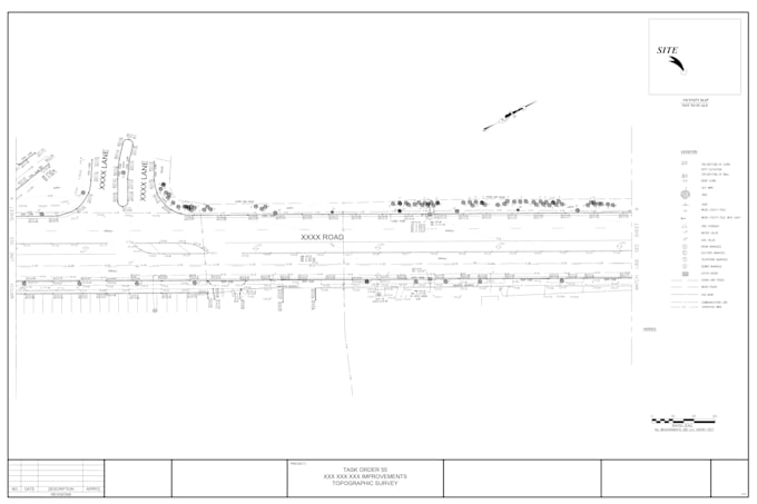
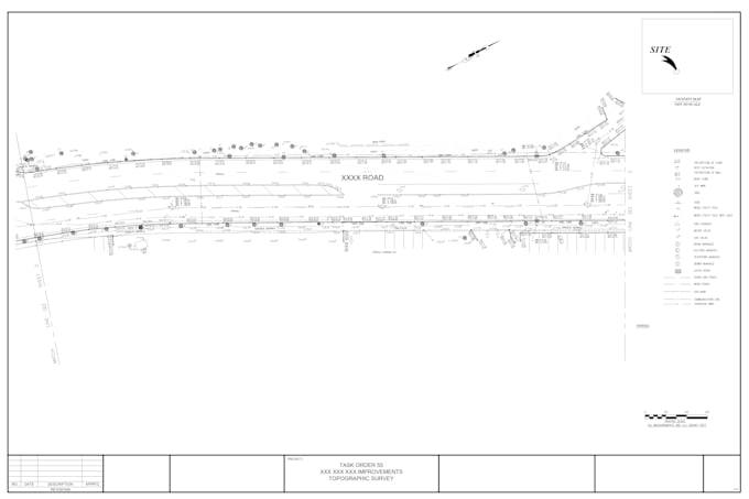
I am able to handle all types of survey projects, including drone, point cloud, ALTA, boundary survey, and topographic surveys.

Delivery style preference

Please inform the freelancer of any preferences or concerns regarding the use of AI tools in the completion and/or delivery of your order.

Get to know Pravin Savant

Pravin Savant

Land surveying i Land Development I Walkthrough I Scan to BIM I Point cloud

  • FromIndia
  • Member sinceJan 2026
  • Avg. response time2 hours
  • Languages

    English
Land Surveying, Civil Engineering & Architectural Services: I provide land surveying services including boundary, topographic, as-built, lot, and UAV (drone) surveys. I deliver civil design and CAD drafting using AutoCAD and Civil 3D for land development projects, covering site layouts, grading, earthwork, road profiles, drainage, utilities, and erosion control. I also prepare architectural permit drawing sets with architectural, structural, and civil coordination, as well as 3D modeling, renderings, walkthroughs, and point cloud–based documentation.