Browse categories
Explore
Fiverr Pro
English
$
USD
Spatial Science for Research Excellence
Need accurate land use and land cover (LULC) maps backed by published research not just a rough classification?
I am a researcher on global urban land use efficiency, so this is not a side skill it is my primary area of work.
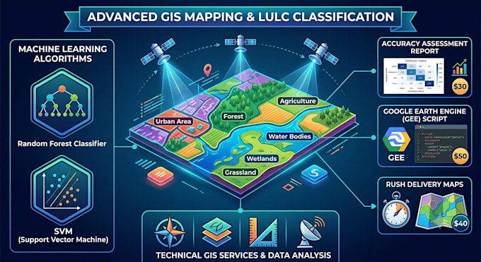
What I offer:
- Supervised classification (Random Forest, SVM, CART) and unsupervised clustering (K-Means, ISODATA)
- Multi-class LULC mapping: built-up, vegetation, water, bareland, cropland, and more
- Multi-temporal LULC analysis to track change over years or decades
- Accuracy assessment with overall accuracy, Kappa coefficient, and confusion matrix
- Urban expansion and impervious surface mapping
- Flood extent, cropland, or forest cover extraction
- Compatible sensors: Sentinel-2, Landsat-7/8/9, MODIS, PlanetScope (if provided)
- Outputs in GeoTIFF, Shapefile, or publication-ready PDF map
What you get:
- Classified raster or vector map of your study area
- Legend, scale bar, and north arrow included
- Methods description suitable for use in academic papers
- Accuracy metrics (on request or included in Standard/Premium)
- Reusable GEE script (available as add-on or in Premium)


What input do I need to provide?
Just share your study area — a city name, country, coordinates, or a shapefile boundary. I handle all satellite data access via Google Earth Engine. Optionally tell me your preferred time period and land cover classes. No data downloads needed on your end.
How accurate will the classification be?
Accuracy varies by landscape complexity and sensor resolution, but I typically achieve 85–95% overall accuracy. Every Standard and Premium order includes a confusion matrix and Kappa coefficient so you have a documented, verifiable accuracy report.
Can I use this map in a published journal paper?
Yes. I document the full workflow — sensor, preprocessing steps, classification algorithm, and accuracy metrics — in a format suitable for the methods section of a research paper. I also include spatial resolution, projection, and data source references.
How many land cover classes can you map?
Typically 5–8 classes (e.g., built-up, vegetation, water, cropland, bareland, forest). More classes are possible but reduce accuracy if the study area is small or imagery is limited. We will agree on the class scheme before I start the classification.
What if my study area is very large or in a remote region?
Large areas are fine — GEE handles continental and global scales. Remote regions with limited cloud-free imagery may need a longer time window or sensor blending. Message me with your area first and I will confirm data availability before you place an order.