Browse categories
Explore
Fiverr Pro
English
$
USD


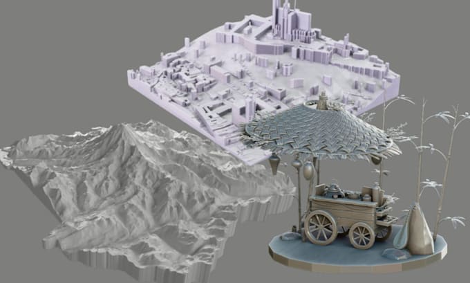
Hello! are you looking for a skilled 3d artist you can trust to create a precise 3d topographic map stl for 3d printing? I design custom 3d terrain models, elevation map 3d models, and 3d printable terrain files from real world locations including mountains, cities, islands, parks, and landscapes and each terrain model is engineered for fdm and resin printers with clean, watertight mesh, proper wall thickness, accurate scaling, and optimized detail for smooth slicing and reliable printing results.
WHAT I OFFER:
WHY CHOOSE ME:
Before ordering, please make sure to message me before placing order and send location name or coordinates, desired size, printer type, and detail level.
Message me today and lets create your custom 3d topographic terrain model ready for flawless 3D printing.
Please inform the freelancer of any preferences or concerns regarding the use of AI tools in the completion and/or delivery of your order.
3d sculpt diorama
Languages
Do you provide a print ready stl file for 3d printing?
Yes, every custom 3d topographic map stl and 3d terrain model is delivered as a clean, watertight, manifold stl file optimized for fdm and resin 3d printing, your elevation terrain model is ready for cura, prusaslicer, or bambu studio slicing.
Can you create a 3d elevation map from any real world location?
Yes. I can convert real world location data, mountain terrain, island maps, city elevation, park landscapes, or geographic terrain into a precise 3d printable topographic map model.
Is the 3d terrain model compatible with my printer?
Your 3d printable map stl is scaled to your printer size and optimized for common fdm and resin 3d printers. Proper wall thickness, terrain depth, and structural stability are considered to reduce print failure.
What file format will I receive?
You will receive a high resolution stl file suitable for 3d printing terrain models, diorama bases, architectural landscape models, and elevation map prints.
What information do you need before starting?
Please send: • Location name or GPS coordinates • Desired dimensions • Printer type FDM or resin • Level of terrain detail • Intended use display, gift, architecture, study