Browse categories
Explore
Fiverr Pro
English
$
USD


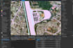

Ready to turn your raw data into precise digital maps? Click the 'Continue' button to select a package, or contact me now if you have specific technical questions. Let's work on your GIS project to professional standards!
gis expert
Languages
What data do you need to start this project?
I need your primary data source, which can be an image file (JPG/PNG), a PDF document, a scanned paper map, or point coordinates. If you have a specific coordinate system reference (e.g., WGS84 or UTM), please provide it.
What file formats will I receive at the end of the project?
I will provide the final output in an industry-standard vector format such as Shapefile (SHP), GeoJSON, KML/KMZ (for Google Earth), or DXF/DWG (for AutoCAD). I can also provide layout maps in high-resolution PDF or JPG formats.
Do you guarantee coordinate accuracy (Georeferencing)?
Yes, of course. I perform high-precision georeferencing using accurate control points (GCPs). If your source data doesn't have coordinates, I will use the latest satellite imagery as a reference to ensure the object's position matches its actual location on Earth.
Can you add data attributes (data tables) to each object?
Yes. If you have additional data (such as landowner names, area size, or land use type), I can input it into an Attribute Table so it can be further processed in GIS software.
Are you able to work on large-scale projects (e.g., a district)?
Yes, I accept large-scale projects. However, for large volumes of work, please contact me first via the chat feature so we can discuss the timeline and a more competitive price.


