Browse categories
Explore
Fiverr Pro
English
$
USD
Hydrologist HECRAS, HECHMS, GIS and ML for Flood and Climate Risk
Need to know which areas, buildings and roads flood, how deep, and how risky it is? I deliver a complete 2D flood study, from river floods (fluvial) to heavy-rain flooding in towns and drainage areas (pluvial), rain on mesh with a clear risk assessment.
WHAT YOU GET
Rainfall-Runoff modeling with calibration and validation
HEC-RAS 2D inundation modeling (river flooding and rain-on-mesh)
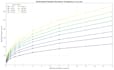
Design floods for chosen return periods (e.g. 10, 50,
100-year)
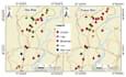
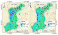
Flood depth, velocity and extent maps
Flood hazard classification
Exposure analysis in QGIS (buildings, roads, population,
land use)
Vulnerability and risk maps (hazard x exposure x
vulnerability)
Report with methods, results and recommendations
GOOD FOR
Municipalities, NGOs, consultants, researchers,
developers, and climate-resilience projects.
WHY ME
Civil engineer (UET Peshawar). First author of a
Scientific Reports paper on flood hazard modeling. Experience on UNICEF ADB and
GIZ funded flood risk projects and multi-hazard risk assessment for
infrastructure.
TO START
Send your study area (KMZ or shapefile), the purpose, and
any data you have (rainfall, flow, building footprints).

Project scale:
Building
Building type:
Industrial
•
Institutional & public
•
Infrastructure
Material speciality:
Concrete
Please inform the freelancer of any preferences or concerns regarding the use of AI tools in the completion and/or delivery of your order.
Do I need a high-resolution DEM
No, I can start with open DEM data and also I can perform Resampling. A finer DEM (drone or LiDAR) improves accuracy, so send it if you have it.
What if there is no flow data
I estimate design floods from rainfall using hydrological modeling
How do you define hazard and risk
Hazard comes from flood depth and velocity. Risk combines hazard with exposure and vulnerability.
Difference between fluvial and pluvial flood risk assessment
Fluvial flooding comes from rivers overflowing. Pluvial flooding comes from intense rainfall that the ground or drainage cannot handle.


