Browse categories
Explore
Fiverr Pro
English
$
USD


Hi,
I am a professional GIS Analyst with 5+ years of experience in GIS mapping, spatial analysis, and data visualization. I help clients transform raw spatial data into clear, accurate, and visually compelling GIS maps for reports, research, business insights, and presentations.
️ GIS Mapping & Spatial Analysis
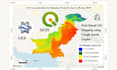
I create custom GIS maps including choropleth maps, heatmaps, thematic maps, and point maps using QGIS, ArcGIS, and GRASS GIS. Services include data collection, georeferencing, projection, cleaning, and spatial analysis.
️ Remote Sensing & Image Analysis
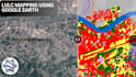
I provide remote sensing services such as satellite image analysis, image classification, change detection, NDVI, and index analysis using satellite, UAV/drone, LiDAR, and aerial imagery.
Interactive & Web Mapping
I develop interactive GIS maps using Mapbox, Leaflet, and Google Maps API, including pop-ups, layer controls, and dynamic data visualization for websites and dashboards.
️ GIS Automation & Custom Scripts
I create Python and MATLAB GIS scripts for geoprocessing automation and custom spatial analysis workflows.
Custom Map Design
Professionally styled data visualization maps optimized for print, reports.
Expert GIS Mapping and Spatial Analysis for Your Business
Languages
What data do I need to provide?
You can provide your data in Excel, CSV, Shapefile, GeoJSON, or KML format. If you don’t have data, I can also source reliable public GIS data or guide you on what is needed.
Which GIS software do you use?
I work with QGIS, ArcGIS / ArcGIS Pro, and GRASS GIS. For automation and advanced analysis, I also use Python and MATLAB.
What type of GIS maps can you create?
I can create choropleth maps, heatmaps, thematic maps, point maps, topographic maps, and location maps. I also offer interactive web maps using Mapbox or Leaflet.


