Browse categories
Explore
Fiverr Pro
English
$
USD
Lidar Photogrammetry Engineer
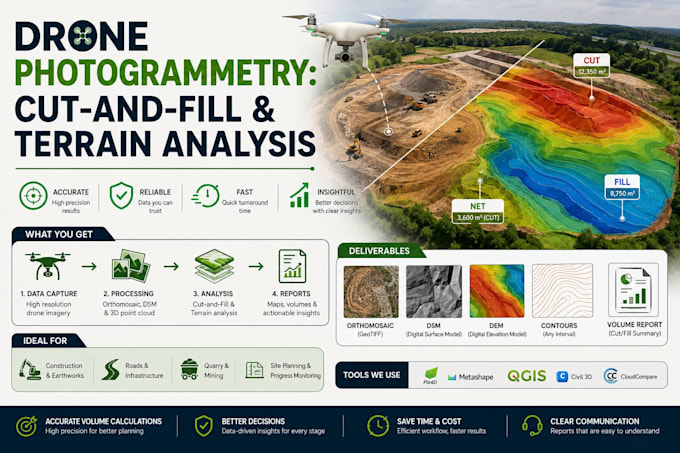
I turn processed drone photogrammetry output (WebODM, Pix4D, DroneDeploy, or similar) into the terrain products a site actually needs: cut-and-fill volumes, contour maps, elevation profiles, and proposed-grade surfaces. Delivered for a real earthwork/grading job, not a generic GIS exercise.
What you get:
Why me: civil engineering background (undergrad) plus GIS/remote sensing (Master's) I understand the engineering side of "how much dirt moves," not just the mapping side.
Process:
I only have raw drone photos, not a processed DTM
Yes, message me first so I can scope the photogrammetry processing step separately.
What file formats do you accept/deliver?
Accepts GeoTIFF, LAS/LAZ, common orthomosaic formats; delivers GeoTIFF, DXF, PDF, and shapefile/contour formats.
Can this be used for permit submission?
I can format outputs to be engineer/permit-friendly, but I'm not a licensed surveyor — have a licensed professional review before submission if that's required in your jurisdiction.
