I will make 3d animation and interactive maps

S
smihigis
S
smihigis
Med Smihi

Level 1

About this gig

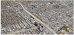
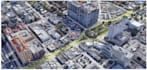
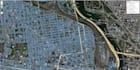
Making 3D animations created using a DEM and an orthoimage via ArcGIS Pro, as well as interactive maps in OpenLayers and Leaflet APIs.

The delivrables are high quality with a professional rendering.

Get to know Med Smihi

Med Smihi
5.0(16)

Level 1

  • FromMorocco
  • Member sinceJun 2021
  • Avg. response time1 hour
  • Last delivery2 weeks
  • Languages

    English, Arabic, French
I'm a Remote Sensing & GIS engineer with consistent experience in GIS projects management and hydrology. I'm certified in ArcGIS & Erdas Imagine software. I put at your disposal my services at a reasonable price. In addition to that, i would like to inform you that i master traduction in the three languages listed below. UpWork Top Rated Freelancer.