Browse categories
Explore
Fiverr Pro
English
$
USD
Are you looking for high-quality remote sensing and GIS analysis using Google Earth Engine (GEE)? You're in the right place!
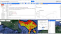
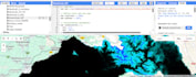
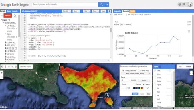
I am a Remote Sensing and GIS specialist with hands-on expertise in satellite image analysis, particularly using Google Earth Engine, a powerful cloud-based platform for large-scale geospatial data processing.
With a strong academic and technical background, I have worked extensively on various Earth observation projects using Sentinel-1, Sentinel-2, and Landsat data for environmental monitoring, agricultural analysis, disaster mapping, and more.
My Services Include:
Whether you need a one-time analysis or a fully automated and repeatable script for continuous monitoring, I can help you achieve your project goal