Browse categories
Explore
Fiverr Pro
English
$
USD

HELLO THERE!
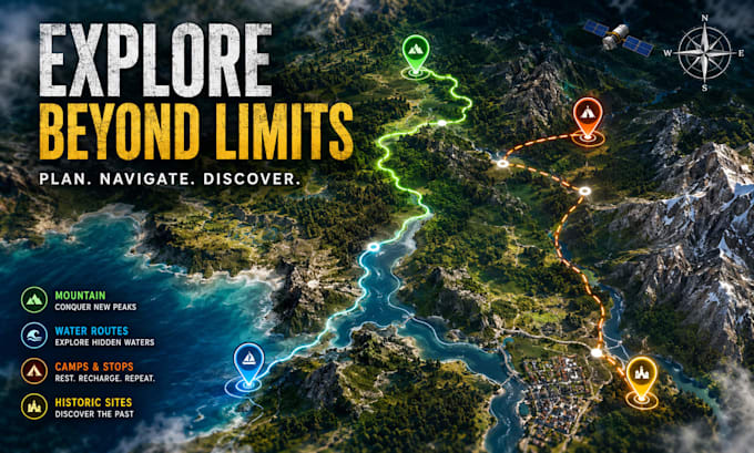
Need a professional satellite map, aerial view map, or route planning map?
I create custom mapping solutions designed for navigation, expeditions, tourism projects, outdoor adventures, real estate, and business applications.
Using satellite-inspired visuals and detailed cartography techniques, I design clear, accurate, and visually engaging maps tailored to your project.
WHAT I OFFER:
WHY CHOOSE ME:
Contact me before ordering to discuss your project requirements.
Please inform the freelancer of any preferences or concerns regarding the use of AI tools in the completion and/or delivery of your order.
Interactive Map Designer
Languages
What do you need to start?
Please provide location details, routes, landmarks, reference images, and design preferences.
Can you create maps from satellite images?
Yes, I can create custom maps inspired by satellite and aerial imagery.
Can you create expedition and navigation maps?
Yes, I specialize in route planning, navigation, and expedition mapping.
Do you offer commercial use?
Yes, maps can be created for commercial, tourism, and business purposes.
What file formats will I receive?
PNG, JPG, PDF, and source files (Premium package).