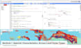
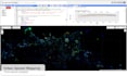
Geospatial Data Analysis and Visualization with Google Earth Engine
Feel free to send me your offers, inquiries, and project details, and lets discuss the best support I can provide for your geospatial analysis and visualization needs.
Example Services:
- Vegetation monitoring: NDVI/EVI time-series from MODIS, Landsat, Sentinel-2
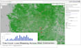
- Land cover change detection: forest loss, urban expansion
- Climate & environmental trend analysis: rainfall, temperature, drought index
- Carbon stock & emission proxy analysis: biomass, fire, land cover dynamics
- Surface water mapping: water body extent using NDWI/MNDWI
- Burn area mapping: pre/post event using thermal and NBR indices
- Crop monitoring & agricultural zoning: phenology, productivity analysis
Example Processing:
- Data Collection & Filtering: pull satellite or climate datasets from GEE catalog
- Preprocessing: cloud/shadow masking, mosaicking, temporal aggregation
- Feature Extraction: vegetation indices, land cover classes, water indices, etc.
- Statistical/ML Analysis: time-series trends, spatial classification, anomaly detection
- Export & Visualization: Maps (PNG/GeoTIFF), graphs (CSV/JSON), or web app visualization
- Create google earth engine apps.