Geospatial Analysis and Visualization using GIS Software
Feel free to send me your offers, inquiries, and project details, and lets discuss the best support I can provide for your geospatial analysis and visualization needs.
Example Services:
- Time series Land cover/use change analysis
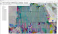
- Vegetation index mapping (e.g., NDVI, EVI)
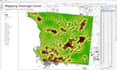
- Suitability analysis (e.g., for crops, settlements, conservation)
- Flood or erosion-prone area identification
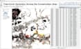
- Model builder
- Custom map design for research, reports, or planning
- Spatial planning support (e.g., zoning, buffer analysis)
- Infrastructure and accessibility mapping (e.g., roads, services).
️ Example Processing:
- Data Cleaning & Projection: Reprojection, geometry fixing, and spatial join
- Raster & Vector Processing: Reclassification, raster calculation, masking, clipping
- Overlay Analysis: Intersect, union, dissolve, spatial join
- Zonal & Statistical Analysis: Calculate mean, sum, or other stats per zone
- Visualization: Custom symbology, labeling, layout creation (PDF, PNG, etc.)
- Export: Provide data outputs in desired formats (GeoTIFF, SHP, CSV, etc.)
- Comprehensive reporting: scientific report, infographics
Tools: ArcGIS, QGIS, Google Earth Engine