Browse categories
Explore
Fiverr Pro
English
$
USD

Level 2


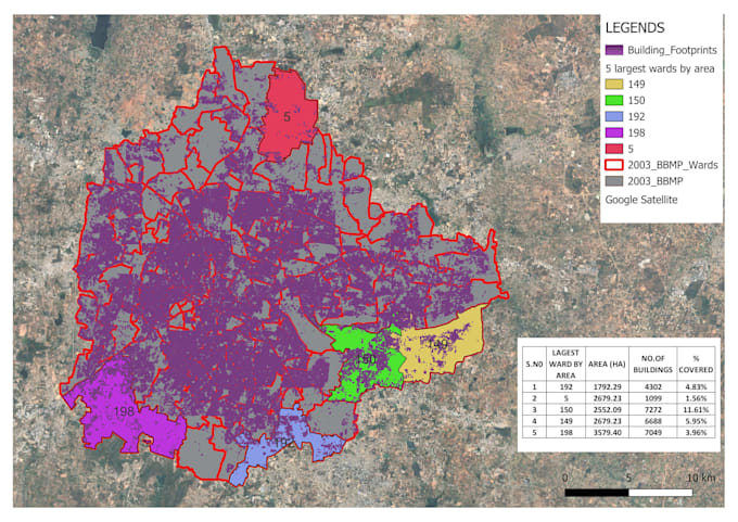
Welcome to my QGIS Mapping & Analysis Service!
Im a QGIS user with practical skills in spatial data visualization, terrain modeling, and data-driven GIS analysis. I can support your project with clean, accurate, and insightful GIS outputs for academic, planning, environmental, or professional needs.
My QGIS Services Include:
Geo-referencing old maps, scanned layouts, or blueprints
Creating and analyzing DEM (Digital Elevation Models)
Generating hill shades and slope/terrain analysis
Designing contour maps with custom intervals
Data-driven GIS analysis (e.g., elevation profiles, land use distribution, area calculations, buffer zones, heatmaps, etc.)
Layer styling with symbiology, labels, legends, scale bars, and north arrows
Exporting high-resolution maps for print or presentation
GIS reports with visual + tabular data insights (if required)
Deliverables may include:
Unlimited revisions | On-time delivery | ️ Friendly communication
Not sure what package fits your project? Message me anytime.
architect and visualizing artist
Level 2
Languages