I will process lidar point cloud data into dtm, dsm, dem, and contour lines

S
stefan_duca
S
stefan_duca
Stephen Duca

About this gig

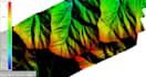
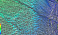
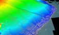
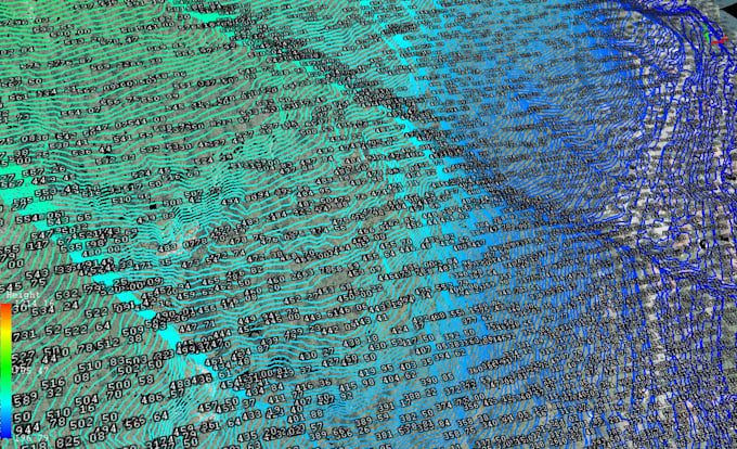
Professional LiDAR Point Cloud Processing DTM, DSM, DEM & Contours

I will process your raw LiDAR/point cloud data (.las / .laz) and deliver high-quality outputs including:

  • LiDAR Classification
  • DTM (Digital Terrain Model)
  • DSM (Digital Surface Model)
  • DEM (Digital Elevation Model)
  • Contour Lines - vector contours at your preferred interval (1m, 2m, 5m, etc.)
  • Classified Point Cloud - .las/.laz output ready for further use

Output formats: GeoTIFF, SHP, DXF, LAS/LAZ, KMZ just ask

Whether you're working on civil engineering, surveying, forestry, hydrology, or urban planning I deliver precise results with fast turnaround.

Message me before ordering to discuss all the details and get an exact price for your project.

Get to know Stephen Duca

Stephen Duca

LiDAR data processing

  • FromRomania
  • Member sinceMar 2026
  • Languages

    Romanian, English
I am a geodetic engineer with a Master’s degree in Geomatics and GIS, specialized in remote sensing and photogrammetry. My main focus is on LiDAR data processing and drone-based surveying, including aerial mapping, 3D point cloud generation, and orthophoto production.

My Portfolio

Related tags