Browse categories
English
$
USD
Connect to your AI



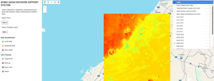
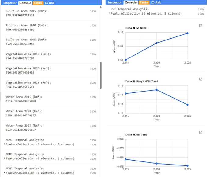
GEOSPATIAL ANALYSIS | GOOGLE EARTH ENGINE | QGIS
Need help with satellite imagery, remote sensing, or GIS mapping? I can help turn geographic data into clear maps, visualizations, and useful insights.
SERVICES I OFFER
WHY WORK WITH ME?
I am a CSE student with experience in spatial data engineering, remote sensing, and geospatial web applications. I focus on understanding your requirements and delivering well-organized, documented results.
WHAT I NEED FROM YOU
Please provide your study area, research objective, dataset (if available), date range, and expected output.
IMPORTANT
Complex projects may require a custom offer. Please contact me before ordering to confirm feasibility, scope, and delivery time.
Let's turn your geospatial project into meaningful results!
Geospatial Data Engineer
Languages
What GIS services do you provide?
I offer Google Earth Engine analysis, QGIS mapping, satellite imagery processing, spatial analysis, NDVI/NDBI calculations, and geospatial visualization.
Which satellite datasets can you work with?
I can work with suitable Landsat and Sentinel datasets, depending on the analysis requirements and data availability.
Do I need to provide my own data?
Not always. Share your study area and requirements, and I can help identify suitable public datasets where available.
Can you handle custom GIS projects?
Yes. Please message me with your project objective, study area, required analysis, and expected deliverables before ordering.
Do you provide source code?
Source code can be included when agreed in the selected package or custom offer.