Browse categories
English
$
USD
Connect to your AI

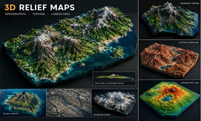
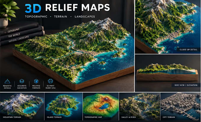
Need a custom 3D relief map, topographic map, or detailed terrain model of a real location?
I create custom 3D relief maps and terrain models that transform geographic locations and elevation references into detailed 3D visuals. Whether you need a mountain range, island, city area, or landscape, I can tailor the model to your project requirements.
MY SERVICES INCLUDE:
WHY CHOOSE MY SERVICE?
Your project may be for 3D printing, education, landscape visualization, or a personal display.
Please send your location, reference map, desired dimensions, intended use, and preferred file format before ordering. I will confirm feasibility, project scope, and the appropriate package.
CONTACT ME BEFORE ORDERING for complex locations, CNC requirements,
Please inform the freelancer of any preferences or concerns regarding the use of AI tools in the completion and/or delivery of your order.
3D Terrain Modeler Topographic Maps and 3D Landscapes
Languages
Can you provide an STL file for 3D printing?
I can assess requests for locations worldwide. Please provide the location name, coordinates, or map reference so I can check the available data and project requirements.
What is the difference between a relief map and a topographic map?
A relief map emphasizes the shape and elevation of the land, while a topographic map typically represents terrain using elevation information such as contour lines. The exact output depends on your requirements.
Can you provide an STL file for 3D printing?
STL output can be provided when the selected package and project scope support it. Please confirm your printer requirements, dimensions, and intended use before ordering.
Can you model mountains, islands, valleys, or coastlines?
Yes, depending on the location, available references, and project complexity. Send your requirements so I can confirm what is feasible.
Can you create a map from coordinates?
Provide the coordinates, desired area, and approximate dimensions. I will assess whether suitable elevation data is available for your project.
Which file formats do you deliver?
The available formats depend on your requirements and the agreed package. Please confirm your preferred format before placing an order.
Can you create CNC-ready terrain?
CNC-ready work requires specific geometry and manufacturing requirements. Contact me first so I can confirm whether I can meet your machine and file specifications.
What information do you need to start?
Please provide your location or coordinates, reference map, desired dimensions, terrain style, intended use, required details, and preferred file format.