Browse categories
Explore
Fiverr Pro
English
$
USD


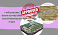
I provide professional drone survey data processing and deliver high-precision orthomosaic maps, DEM & DSM models, and topographic maps tailored to your project needs. With my expertise in photogrammetry, GIS mapping, and survey data analysis, I convert raw drone imagery into accurate, construction-ready outputs for architects, engineers, developers, and surveyors.
Heres what I offer:
Whether you need aerial survey data for land development, construction planning, or GIS projects, my service ensures precise and reliable results. I focus on accuracy, efficiency, and usability, so your data is ready for immediate use in reports, planning, or CAD/GIS software.
Lets bring your survey data to life with professional drone map
Please inform the freelancer of any preferences or concerns regarding the use of AI tools in the completion and/or delivery of your order.
Professional Civil Engineer
Languages
What kind of drone data do you accept?
I accept data from all standard drones, including DJI, Autel, and other UAVs. Raw images, video footage, or GPS-tagged data are all compatible for processing into orthomosaic maps, DEM/DSM models, and topographic outputs.
What formats will I receive?
I deliver your processed survey outputs in multiple formats: GeoTIFF, JPEG, PDF, AutoCAD-compatible files (DWG), and GIS-ready formats (Shapefile, KML, or KMZ), depending on your project needs.
How accurate are the orthomosaic and DEM/DSM models?
Accuracy depends on your drone’s specifications and flight parameters, but I ensure professional-grade processing for precise topographic, contour, and survey-ready results suitable for construction, planning, and GIS projects.
Can you create outputs for construction or GIS software?
Yes! All maps and models are processed to be construction-ready or GIS-compatible, so you can easily use them in AutoCAD, Civil 3D, ArcGIS, QGIS, or other platforms.
What is your turnaround time?
Standard projects are delivered within 5–7 days, depending on data size and complexity. Express delivery is available for urgent projects.
Do you provide revisions?
Yes! I offer revisions to ensure your orthomosaic maps, DEM/DSM models, and topographic outputs meet your exact requirements. Your satisfaction is my priority.
