Browse categories
Explore
Fiverr Pro
English
$
USD

-Layout1_vk6x4s.jpg)

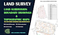
Are you looking for a professional Land Surveyor to convert your raw field data into highly accurate topographic contour maps, survey plans, and land subdivisions?
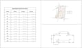
With a B.Sc. Hons in Surveying Sciences and years of practical field experience, I specialize in transforming raw survey data (Total Station, GPS, or RTK) into precise, industry-standard engineering drawings. I use advanced software like AutoCAD Civil 3D and SOKKIA Link to ensure 100% technical accuracy and clean drafting.
My Services:
What I Need:
Why Choose Me?
Please get in touch with me before ordering to discuss your project details and get a custom quote!
Please inform the freelancer of any preferences or concerns regarding the use of AI tools in the completion and/or delivery of your order.
Design is intelligence made visible!
Languages
What type of survey data do you accept?
I accept raw point data formats including CSV, TXT, Excel, or XYZ files exported directly from your Total Station, GPS, or DGNSS equipment.
Can you handle large land subdivision projects?
Absolutely. My Premium package covers large-scale, complex land subdivisions and topographic mapping projects over 10 acres. Please message me for custom quotes on massive sites.
Do you provide the source files?
Yes, all packages include the fully editable source AutoCAD drawing files (.DWG) along with high-resolution PDF outputs for easy viewing.
Which software do you use for drafting?
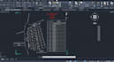
I use industry-standard software including AutoCAD, AutoCAD Civil 3D, and SOKKIA Link to process your points and draft the maps accurately.


