Browse categories
Explore
Fiverr Pro
English
$
USD

Hello and Welcome!
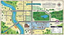
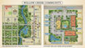
Need a professional GIS map, subdivision map, parcel map, land map, property map, or site visualization?
I can transform your available map data, survey reference, sketch, property information, GIS data, or existing drawing into a clean and professional map presentation.
What I Offer:
Depending on your project, maps can include parcels, roads, lots, boundaries, labels, landmarks, zoning information, utilities or other information provided by you.
Important: This service provides map design and visualization based on supplied information. It does not replace licensed surveying, engineering, legal boundary determination, or official permit documents where those are required.
Send your files, sketch, reference, or project details, and I will create a professional and easy to understand map for your project.
Please inform the freelancer of any preferences or concerns regarding the use of AI tools in the completion and/or delivery of your order.
Professional Map Illustrator, GIS, Real Estate, Property and Vector Maps
Languages
What do you need to start?
Please provide your location, address, map reference, sketch, existing drawing, GIS data, property information, desired style, and all text or labels you want included.
Can you create a map from Google Maps or another reference?
Yes, you can provide a reference or location information. I will use the information you provide to create a custom map design appropriate for your project.
Will I receive a source file?
Source files can be included where available and selected in the package or as an extra.
Can you match my company branding?
Yes. You can provide your logo, brand guidelines, colors, fonts, and examples of your preferred style.
Can you create a large or complex map?
Yes. Please message me before ordering so I can review the scope and provide the appropriate package or custom offer.
Are these official survey, engineering, or legal maps?
No, unless you are specifically qualified and authorized to provide such services. The maps are professional design and visualization deliverables based on supplied information and should not be represented as certified survey or legal documents.


