Welcome to my professional GIS and Remote Sensing Gig!
I offer expert spatial analysis, satellite data processing, and custom GIS map creation services tailored to your specific requirements.
Services Offered:
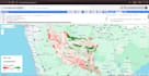
- GIS Mapping & Layout: Vector digitizing, georeferencing, shapefile creation, and high-quality thematic map production (QGIS & ArcGIS).
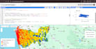
- Remote Sensing & Satellite Processing: Multispectral optical imagery processing (Sentinel-2, Landsat), Land Surface Temperature (LST), and NDVI calculations.
- Google Earth Engine (GEE): Custom JavaScript/Python scripting for large-scale environmental monitoring and change detection.
- Advanced Data Processing: Synthetic Aperture Radar (SAR) imagery processing, LiDAR point cloud handling, and spatial modeling.
- GeoAI & Classification: Land Use/Land Cover (LULC) mapping using Random Forest and Machine Learning algorithms.
Why Choose Me?
- Solid academic background in Surveying Sciences & Geomatics.
- High-precision output formatted to standard publication quality.
- Prompt communication and timely delivery.
Please contact me before placing an order to discuss your project requirements in detail!