Browse categories
Explore
Fiverr Pro
English
$
USD
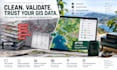

A beautiful map cannot rescue bad spatial data.
I help organisations, researchers and project teams turn messy GIS files into reliable, usable geospatial data.
I can clean, convert and validate your GIS data in QGIS, including:
I am a Senior GIS and Digital Systems Consultant with 25+ years of professional experience in cartography, geodatabases, territorial analysis and field-data systems. My work has included national and municipal cartography, major infrastructure, agriculture and rural-development systems across Europe, Africa and Asia.
I do more than convert files: I check what the data can actually support, flag uncertainty and deliver an organised result you can confidently use for mapping, analysis, reporting or integration.
Please message me before ordering large, complex or inherited GIS datasets.
GIS, Data, Moodle, MR and Open Source Systems
Languages
What GIS formats can you work with?
I work with common GIS formats including Shapefile, GeoPackage, GeoJSON, KML/KMZ and coordinate-based CSV files. If you have an unusual or proprietary format, message me first.
Can you fix invalid geometries and GIS errors?
Yes. Depending on the package, I can identify and repair common geometry problems, projection issues, duplicate features and structural inconsistencies.
Can you clean the attribute data too?
Yes. I can review field structure, inconsistent naming, duplicate records, missing values and other agreed attribute-quality issues alongside the spatial data.
Can you convert my data to another coordinate system?
Yes. I can check and transform CRS/projections when the source reference system is known or can be reliably established.
Can you work with large or complex GIS datasets?
Yes, but please contact me before ordering. Large datasets, many layers, raster collections or inherited GIS projects may require a custom offer.
Will I receive editable GIS files?
Yes. You will receive the agreed cleaned, converted or validated GIS files in the selected output format. Higher packages can also include QA and metadata documentation.
Can you work with cadastral or property data?
Yes, I can clean, structure and process authorised cadastral or property-related GIS data. However, I do not provide legal cadastral certification or guarantee positional accuracy beyond the quality of the supplied source data.


