Browse categories
Explore
Fiverr Pro
English
$
USD



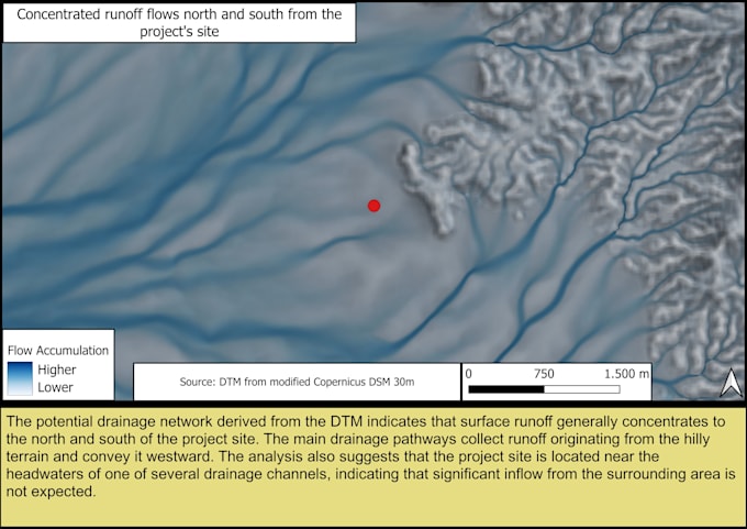
This project interprets potential surface runoff movement accross a particular landscape. Where does runoff concentrate? Which areas are likely to collect water? Where does the water potentially speed up? Theese are the questions that will be answered.
The analysis is based on data extracted from digital elevation model (DEM) and, if needed, from digital terrain model. The premium package includes satellite imagery overlayed. This way the data generated by DEM analysis is supported by the data format that human's eye can see. This makes the analysis easily understandable. Every data set/map includes geographical interpretation, methodology, data source and data limitations.
This service provides a terrain-based geographic interpretation of potential surface runoff patterns. It is not a flood prediction, hydraulic simulation, or a substitute for engineering studies.
Please inform the freelancer of any preferences or concerns regarding the use of AI tools in the completion and/or delivery of your order.
Terrain Analyst
Languages
Can this analysis predict floods?
No. This service provides a terrain-based interpretation of potential surface runoff patterns using available spatial data. It is not a hydraulic simulation or an engineering flood assessment.
What data do you use?
Depending on the project, analyses may use digital terrain models (DTMs), satellite imagery, and OpenStreetMap data where appropriate. Every report documents the data sources used.
Does the report include limitations?
Yes. Every report includes a brief note describing the methodology, data sources, and any relevant limitations affecting the interpretation.
What type of landscape do you analyze?
This kind of analysis is suitable for all types of landscape but the least accuracy is expected in urban areas. Those areas are heavily modified by the human intervention.
What level of precision do you provide?
Terrain generated data is based on 30m digital elevation model. Landbased and other features smaller than 30m are generalized.