Browse categories
Explore
Fiverr Pro
English
$
USD

Level 1
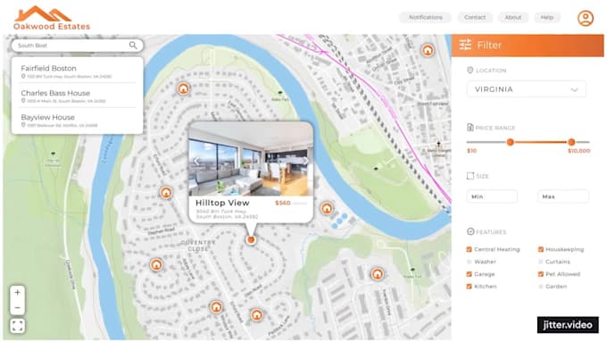
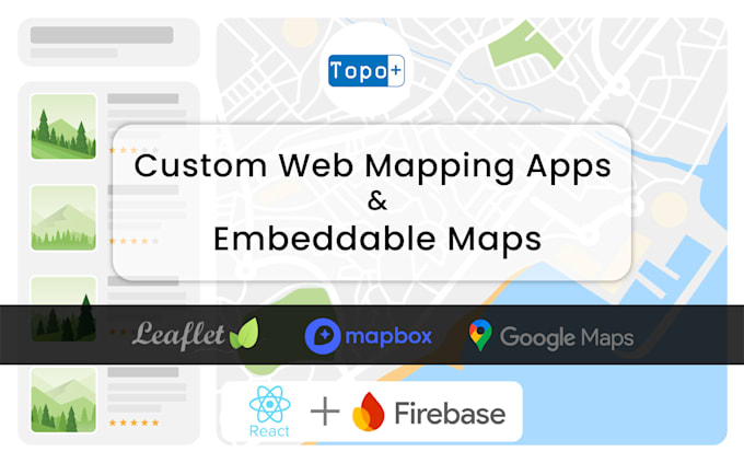
I build everything from simple embedded maps to full-featured web map applications with admin dashboards and live data integration.
⭐ What I Offer:
⭐ Tools & Technologies:
I work with both open-source and commercial libraries, including:
⭐ Additional Perks:
Browse my portfolio to see past projects in action: https://www.fiverr.com/s/YRXWvWa
Contact me to discuss your ideas and get a custom plan tailored to your needs.
One place for Spatial Data Analysis and Visualization
Level 1
Languages
What do I need to provide to get started?
To begin, please share your data (in formats like CSV, Excel, GeoJSON, or shapefiles), a brief description of what the map should show, and any design or color preferences you have.
Can you help me host the map online?
Yes! I provide hosting on Firebase or Vercel. For larger or business-critical apps, I can help you set up custom hosting as needed.
Can I update the data on my own after delivery?
Absolutely! I can create a simple admin panel or form-based interface so you can update, add, or delete features on your map without coding.
What mapping platforms do you use?
I work with top-tier mapping libraries including Mapbox, Leaflet, MapLibre, OpenLayers, and Google Maps. I choose the best one based on your goals and budget.