Browse categories
Explore
Fiverr Pro
English
$
USD


HI THERE
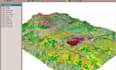
I specialize in creating high-quality GIS maps, ArcGIS projects, land use/land cover classification, geospatial analysis, and data visualization using industry-standard tools. Whether you need environmental mapping, urban analysis, asset mapping, address geocoding, or spatial data processing, I can deliver accurate and well-organized results.
My GIS services include:
Why Choose Me?
GIS DATA ANALYST
Languages
Can you work with satellite imagery and remote sensing data?
Yes, I can analyze and process satellite imagery for various GIS applications.
Do you offer spatial analysis services?
Yes, including buffer analysis, proximity analysis, overlay analysis, hotspot analysis, and more.
Can you create custom GIS maps?
Yes, I create customized maps based on your data, objectives, and preferred map style.
Do you perform land cover and land use classification?
Yes, I provide land cover and land use analysis using satellite imagery and GIS techniques.
Can you geocode addresses and locations?
Yes, I can geocode addresses, coordinates, and perform reverse geocoding services.


