Browse categories
Explore
Fiverr Pro
English
$
USD


Turn your geographic data into clear, accurate, and actionable insights with professional GIS services tailored to your project needs.
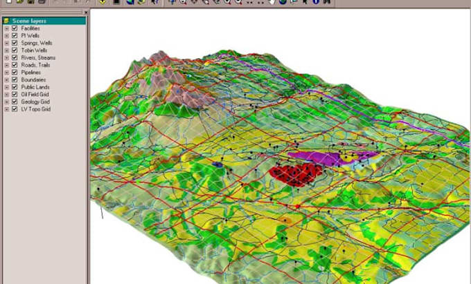
I specialize in ArcGIS mapping, spatial analysis, land cover classification, geocoding, geospatial data processing, and GIS visualization for researchers, businesses, environmental projects, urban planning, and engineering applications. Whether you need a detailed map, location analysis, or land-use assessment, I will deliver reliable results that support better decision-making.
Services I Offer:
Why Choose Me?
I am ready to help transform your spatial data into meaningful results. Contact me today!!!
GIS DATA ANALYST
Languages
What software do you use for GIS projects?
I use professional GIS tools including ArcGIS, ArcGIS Pro, QGIS, and other geospatial platforms.
Can you handle geocoding tasks?
Yes, I can convert addresses into coordinates and perform reverse geocoding for mapping projects. Q: Do you create custom GIS maps? Yes, I create professional thematic maps, analytical maps, and customized GIS visualizations.
Can you handle geocoding tasks?
Yes, I can convert addresses into coordinates and perform reverse geocoding for mapping projects.
Can you work with large GIS datasets?
Yes, I can process and analyze large geospatial datasets while maintaining accuracy and quality.