I will do data cleaning professional gis mapping and georeferencing

U
ubaidullah28
U
ubaidullah28
Ubaidullah

About this gig

With over 5 years of experience as a GIS Analyst, I provide high-precision geospatial solutions tailored for urban planning, environmental studies, and engineering projects. I don't just make maps I build structured, Topology-Verified Geodatabases ready for professional use.


Services I Offer:

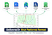
Precision Data Conversion: Expert migration between CAD (DWG, DXF), KML, SHP, and GeoJSON. I specialize in cleaning messy CAD lines into structured GIS polygons.

Advanced Spatial Analysis: Proximity (Buffer), Overlay, and Site Suitability Analysis using Multi-Criteria Decision Making (MCDM).

Remote Sensing (RS): Satellite imagery interpretation, including NDVI, SAVI, and ENVI indices for vegetation and land-use studies.

Surface Modeling: Creation of Digital Elevation Models (DEM), Contours, and TIN surfaces for terrain analysis.

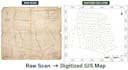
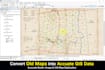
Georeferencing & Digitization: Transforming scanned historical maps or site plans into accurate, georeferenced vector data.

Custom Cartography: High-quality Thematic Maps, Heat Maps, and Infographic-integrated layouts for reports and presentations.


Tools: ArcGIS Pro, ArcMap, QGIS

Get to know Ubaidullah

Ubaidullah

GIS Analyst CAD to GIS Expert

  • FromPakistan
  • Member sinceJun 2021
  • Avg. response time10 hours
  • Languages

    English, Urdu
I am a GIS Analyst with 5+ years of experience in spatial data engineering and urban master planning. I specialize in converting complex CAD data into high-quality, topology-verified GIS datasets. From thousand acre residential schemes to precise georeferencing and 3D surface modeling (DEM/TIN), I provide professional-grade geospatial solutions using ArcGIS, ArcGIS Pro, QGIS, and Python automation. GIS Mapping Spatial Analysis CAD to GIS Conversiom Georeferencing Remote Sensing ArcGIS Pro Digital Elevation Models (DEM) Town Planning Python for GIS Topology Cleaning

My Portfolio