I will do gis analysis, lulc, geoprocessing, image classification

U
udaysm
U
udaysm
Uday Munda
4.7
4.7

About this gig

Remote Sensing & GIS Analyst | Spatial Analysis | Mapping | Image Processing

Looking for a professional Remote Sensing and GIS Analyst? You are at the right place. I provide high-quality GIS, Remote Sensing, Spatial Analysis, and Cartographic Mapping services using ArcGIS, ERDAS IMAGINE, QGIS, and SPSS.


My services include:

  • Study Area & Topographic Maps
  • Cartographic Map Design
  • Landsat & Satellite Image Acquisition
  • Image Processing & Enhancement
  • Raster to Vector Conversion
  • Georeferencing & Projection Adjustment
  • Land Use/Land Cover (LULC) Change Detection
  • Land Surface Temperature (LST) Calculation
  • Hotspot, Buffer & Risk Analysis
  • Hydrological & Spatial Analysis
  • Digitization & Geoprocessing
  • Image Classification & Interpolation
  • Area Calculation from Shapefiles
  • Data Visualization & Geostatistical Analysis

Deliverables:

  • Shapefiles
  • Geodatabases
  • CSV Files
  • PNG/JPEG/PDF Maps
  • AI/EPS/PSD Formats

Why Choose Me?

⭐ Accurate & Professional Work

⭐ High-Quality Cartographic Maps

⭐ Fast Response & Timely Delivery

⭐ 100% Client Satisfaction

⭐ Customized Solutions for Every Project


I always focus on delivering reliable, detailed, and professional GIS solutions according to your project requirements.


Get to know Uday Munda

Uday Munda

GIS and Remote Sensing Analyst

4.7(1)
  • FromIndia
  • Member sinceOct 2019
  • Last delivery1 year
  • Languages

    Hindi, English
I am a GIS & Remote Sensing Analyst specializing in geospatial analysis, satellite image processing, and professional map design. I provide LULC mapping, Land Surface Temperature (LST) analysis, urban heat mapping, watershed delineation, terrain analysis, georeferencing, digitization, and spatial analysis. I work with ArcGIS, QGIS, ERDAS IMAGINE, R, Python, and Excel to create accurate, clear, and visually appealing maps. I focus on quality, attention to detail, and client satisfaction. Let’s discuss your GIS project!

My Portfolio

Reviews

1 reviews for this Gig
4.7

(1)
(0)
(0)
(0)
(0)
Rating Breakdown
  • Seller communication level
    4
  • Quality of delivery
    5
  • Value of delivery
    5
Sort By
Most relevant
  • T
    image-docs

    tharun_ravi

    IN

    India

    4.7

    Really provided the exact work that was requested. Happy to collaborate once again in the future.

    2 days

    Duration
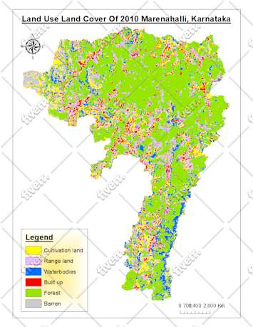
    Worksample image
    Helpful?
    Yes
    No
Reviews

1 reviews for this Gig
4.7

(1)
(0)
(0)
(0)
(0)
Rating Breakdown
  • Seller communication level
    4
  • Quality of delivery
    5
  • Value of delivery
    5
Sort By
Most relevant
  • T
    image-docs

    tharun_ravi

    IN

    India

    4.7

    Really provided the exact work that was requested. Happy to collaborate once again in the future.

    2 days

    Duration

    Worksample image
    Helpful?
    Yes
    No