Browse categories
Explore
Fiverr Pro
English
$
USD


I can provide a free sample for small data before order.
MAKE LAYOUT ACCORDING TO THIS DISCRIPTION
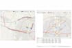
Are you looking to turn your raw data into accurate and professional GIS maps?
Youre in the right place! I specialize in creating high-quality GIS maps, spatial analysis, and geospatial solutions using industry-standard tools like ArcGIS and QGIS.
Whether you have Excel, CSV, or just place names, I can convert your data into precise and visually appealing GIS outputs.
What I Offer:
Excel / CSV to GIS mapping
Geocoding (place names to latitude & longitude)
Digitization (creating shapefiles from maps/images)
Georeferencing of raster data
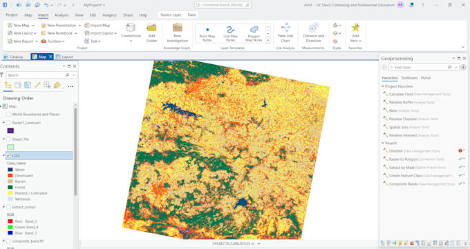
LULC (Land Use Land Cover) classification
Spatial analysis and thematic mapping
Custom GIS visualization
What You Will Get:
Accurate and professional GIS maps
Clean layout with legend, scale, and labeling
Editable GIS files (SHP, GeoJSON, TIFF, etc.)
High-resolution output (PNG/PDF)
Fast and reliable delivery
Why Choose Me?
Experience in real-world GIS and disaster-related projects
Ability to work with data without coordinates
Strong knowledge of ArcGIS and QGIS
Professional and client-focused
GIS Developer
Languages
What kind of data do you need to create a GIS map?
I can work with Excel, CSV, or even simple place name data. If your dataset does not include latitude and longitude, I can perform geocoding to convert place names into accurate coordinates.
Can you work with data that has no coordinates?
Yes, absolutely. This is one of my core strengths. I can convert place names or addresses into latitude and longitude using geocoding and then create accurate GIS maps.
What file formats will I receive?
You will receive your final output in formats such as SHP (shapefile), GeoJSON, CSV, or high-quality map images (PNG/PDF), depending on your requirements.
Do you provide digitization and georeferencing services?
Yes, I can digitize maps from images or PDFs and perform georeferencing to align them with real-world coordinates.
Can you create LULC (Land Use Land Cover) maps?
Yes, I provide LULC classification using GIS and remote sensing techniques to identify land cover types such as vegetation, urban areas, water bodies, and more.
What software do you use?
I use professional GIS tools such as ArcGIS, QGIS, and other geospatial technologies to ensure accurate and high-quality results.
| (1) | ||
| (0) | ||
| (0) | ||
| (0) | ||
| (0) |

twycross3

United States
He understood exactly what was expected and did it right away. Would hire him again
4 days
Duration

Seller's Response
| (1) | ||
| (0) | ||
| (0) | ||
| (0) | ||
| (0) |
twycross3
United States
He understood exactly what was expected and did it right away. Would hire him again
4 days
Duration
Seller's Response