Browse categories
Explore
Fiverr Pro
English
$
USD


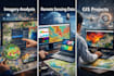

I provide remote sensing and environmental analysis services using satellite imagery, GIS, and data-driven modeling techniques to extract reliable insights for research, planning, and decision-making.
At Vértice360, we focus on analytical accuracy and interpretability, not generic AI solutions. This service is designed for clients who need environmental indicators, land-cover analysis, change detection, or predictive insights based on geospatial data.
What this service includes
Tools & Technologies
Important notes
If you're unsure which package fits your project, contact me before ordering.
GIS Specialist
Languages
Is this a chatbot or generative AI service?
No. This service is for remote sensing and environmental analysis, including satellite imagery processing and modeling. It does not include chatbots or text/image generation tools.
What type of satellite data do you work with?
I work with common public and client-provided datasets (e.g., optical satellite imagery, environmental indices). Specific sensors or datasets can be discussed before ordering.
Do I need to provide the data?
You may provide your own data, or we can use approved public datasets. Custom data acquisition or preprocessing may require additional hours.
What outputs will I receive?
Depending on the package, you may receive: - Maps (PDF, PNG, JPG) - Analytical metrics and summaries - GIS-ready data - Clear interpretation of results
What counts as a revision?
Revisions include minor adjustments to maps or parameters. New datasets, additional time periods, or new analysis objectives require additional hours.
Can you deliver faster?
Yes. Extra Fast Delivery is available for all packages, subject to project complexity.


