Browse categories
Explore
Fiverr Pro
English
$
USD

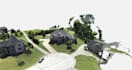
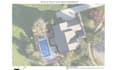


Turn your drone photos into useful aerial maps and 3D models.
I'm a working drone operator with experience delivering maps, models, and construction documentation for client projects. I use WebODM, QGIS, and Sketchfab to process imagery you provide.
BASIC PACKAGE:
Processing of up to 200 drone photos of one site into one orthomosaic map, delivered as a georeferenced GeoTIFF and high-resolution JPG.
AVAILABLE BY CUSTOM QUOTE:
Please message me before ordering so I can review your photos, coverage, intended use, and required formats. Supply original, full-resolution photos with GPS metadata and sufficient overlap.
One revision covers a crop or export adjustment using the original imagery. New photos or additional deliverables require a separate quote.
This is remote processing only. Accuracy depends on imagery and available control data. Deliverables do not replace a licensed land survey.
Owner JCSees Drone Solutions
Languages
What do I need from you?
Please send me your original, full-resolution drone photos with GPS metadata, good overlap, and clear coverage of the site. Tell me how you plan to use the finished map or model and which file formats you need. Message me before ordering so I can review your imagery and con
What will you receive with the basic package?
You will receive one orthomosaic map created from up to 200 drone photos of one site, delivered as a georeferenced GeoTIFF and high-resolution JPG. One revision is included for a crop or export adjustment using the original imagery. Additional photos or deliverables require a separate quote.
Can I create a 3D model or custom map for you?
Yes! I offer textured 3D models, point clouds, digital surface models, scaled PDF maps with labels and image-based measurements, DXF exports of selected mapped features, and interactive model publishing on Sketchfab. These services require a custom quote and suitable source imagery.
How accurate will your map or model be?
Accuracy depends on photo quality, overlap, GPS information, and available ground control. I'll review your imagery and accuracy needs before accepting the project. Specific accuracy is not guaranteed. Deliverables do not replace a licensed land survey.


