Browse categories
English
$
USD
Connect to your AI

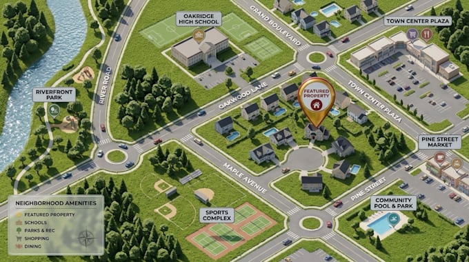
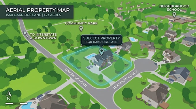
Presenting a property is easier when buyers can clearly understand its location, surroundings and key features.
I create custom real estate maps, property maps and aerial maps that help realtors, property brokers, investors and developers present properties with clarity and professionalism.
Whether you need a map for a residential listing, commercial property, land investment or real estate marketing brochure, I can transform your supplied aerial image, location reference or property layout into a clean and visually appealing map.
MY SERVICES INCLUDE:
WHAT YOU WILL RECEIVE:
My goal is to make your property easier to understand, present and market.
Send your property image, location reference or existing map to get started!
Please inform the freelancer of any preferences or concerns regarding the use of AI tools in the completion and/or delivery of your order.
Master Planning and Architectural Site Visualization
Languages
Can you create an aerial map for my property listing?
Yes. I can annotate a supplied aerial image with property highlights, roads, location markers, boundaries from supplied references and nearby landmarks.
Can you show the property's surrounding neighborhood?
Yes. I can include nearby roads, schools, shopping centers, parks, public facilities and other relevant landmarks when suitable reference information is supplied.
. Can you create a map from a Google Maps or satellite screenshot?
Yes. You can provide a suitable image or other location reference. Please ensure you have the necessary rights to use the source imagery for your intended commercial purpose.
Can you highlight property boundaries?
Yes. I can illustrate boundaries using supplied survey information, parcel references or marked-up images. I do not provide land surveying or certify legal property boundaries.
Can you design maps for commercial real estate?
Yes. I can create commercial property maps highlighting access roads, buildings, parking, surrounding amenities and important location features.
Can you create maps for real estate brochures?
Yes. I can prepare professionally styled maps suitable for brochures, presentations, property listings and digital marketing.
Can you redesign an existing property map?
Yes. I can improve the layout, update labels, highlight important features and refresh the overall presentation.
Can you create a property map without an existing map?
Yes, if you provide a usable location reference, aerial image or sufficient property information. Additional research or reconstruction may require a custom quote.
Do you provide legal or survey certified property maps?
No. This service provides visual property and marketing maps, not legal surveys, certified parcel boundaries or official land documentation.