I will do gis mapping, remotesensing, spatial analysis, erdas, arcgis pro, qgis, arcmap

W
wurkhan
W
wurkhan
Wurkhan

About this gig

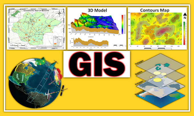
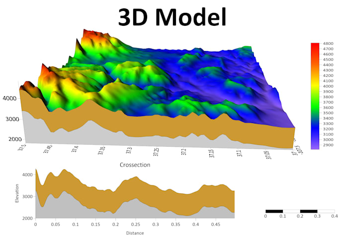
Welcome to my gig! I am a Professional Geologist with 5+ years of experience in Remote Sensing and GIS, I can help you unlock the hidden potential of GIS, remote sensing, Spatial analysis, Image Processing Vector data and Raster Analysis. With my extensive experience and proficiency in utilizing cutting-edge tools like ArcGIS Pro, QGIS, and Erdas Imagine.


My services include:

  • GIS Mapping
  • Density Map
  • GeoRefrencing
  • Data visualization
  • Coordinate System
  • Web Mapping Solutions
  • Satellite Image Processing
  • Remote Sensing and Spatial Analysis
  • Digitization of Point, Lines, & Polygon
  • Land use land cover change mapping
  • Data digitizing and data management
  • Topographic Map(contour, shaded relief)
  • Aspect, Classification, Hill shade, Slope
  • Shapefile, Feature Class, Geodatabase, KML/KMZ etc
  • Research based analysis related to the GIS or remote sensing.


Tools:

  • ArcGIS
  • ArcMap
  • ArcGIS Pro
  • Erdas Imagine
  • Google Earth Pro


Why Choose Me?

  • Availability 24/7
  • Timely Delivery
  • Expertise in Tools
  • Custom Solutions
  • High quality results
  • Clear Communication
  • Client Satisfaction 100%


Let's work together Feel free to message me to discuss your project details!


Thank You.

Get to know Wurkhan

Wurkhan

100 percent Quality and Clients Satisfiction

4.1(11)
  • FromPakistan
  • Member sinceMar 2020
  • Avg. response time4 hours
  • Last delivery1 week
  • Languages

    English, French, Spanish
We are a team of professional Map designers, photo editors, Graphs Charts designers, and Data Analyst. We are motivated and creative professionals with 6 years of experience we work with local and international clients (Academia and Industry). We are a highly Disciplined individual who is laser-focused on achieving results. Our mission is to give high-quality, results to clients. Our team has expertise in Microsoft Office, Graph Pad Prism, SPSS, ArcGIS/ArcGIS PRO, Google Earth, Adobe Photoshop, Adobe Illustrator, and CorelDraw.