Browse categories
Explore
Fiverr Pro
English
$
USD


Need Google Earth files from your Excel or CSV parcel coordinates?
I check your table, normalize supported coordinates, flag geometry issues and prepare a documented Google Earth / GIS handover.
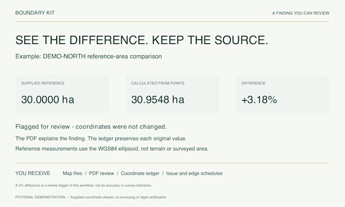
Your delivery includes KML/KMZ, GeoJSON, a PDF review with parcel sketches, a source-to-output coordinate ledger, and reference area, perimeter and edge lengths. I also open the files in Google Earth and provide a visual review image.
Supported inputs: WGS84 decimal degrees or DMS; Standard and Premium also accept known WGS84 UTM zones. Supply the CRS/datum, boundary sequence, approximate location and a readable coordinate table. I can map your existing columns. Unknown CRS or point order must be resolved before work starts.
I flag duplicates, missing sequence numbers, crossings, unexpected locations and parcel overlaps. I report discrepancies rather than invent missing coordinates or silently reshape a boundary.
For project handover and visualization. No surveying, legal boundary certification, map georeferencing or unknown-datum conversion.
Please message me with the format, parcel count and point count before ordering. The gallery uses fictional demonstration data.
React Website Diagnosis and Repair
Languages
Which coordinate systems can you convert?
WGS84 decimal degrees and DMS; Standard/Premium also support WGS84 UTM with a confirmed zone and hemisphere. I do not infer the datum or accept all EPSG systems. Arc 1960 and other local datums are outside this package.
Are area and boundary position legally certified?
No. The report provides WGS84 ellipsoidal reference measurements from the supplied coordinates. It does not establish legal boundaries, ownership, licence validity or surveyed accuracy.
What do revisions include?
Basic and Standard include 1 revision; Premium includes 2. Revisions cover the agreed source and parcels. New parcels or replacement sources need a new scope. Seller errors will be corrected and are not excused by revision limits.
Do you use AI or automation?
Yes. Automated checks and exports support source and visual review. Tell me any restrictions before ordering. Confidential source files are not uploaded to an external AI service without permission.
What makes this different from a free converter?
The paid work includes reviewing your supplied table, checking geometry and location expectations, documenting discrepancies, preparing a multi-format handover, and opening the result in Google Earth. A clean single-boundary export is available in my free tool.
Can you use my existing Excel layout?
Yes, if it contains parcel ID, point ID, boundary sequence and two coordinate columns. I map those columns explicitly. Supply confirmed values rather than spreadsheet formulas.
Can you work from a PDF or scanned map?
Send a non-confidential sample description first. These packages cover readable digital coordinate tables. Transcription from clear tables requires a separate scope review; scan georeferencing, unclear OCR and interpreting a drawn boundary are not included.
Will you repair a crossed boundary?
I identify the problem and request a source-backed correction. I do not reorder points by proximity or guess the intended boundary.