Browse categories
Explore
Fiverr Pro
English
$
USD


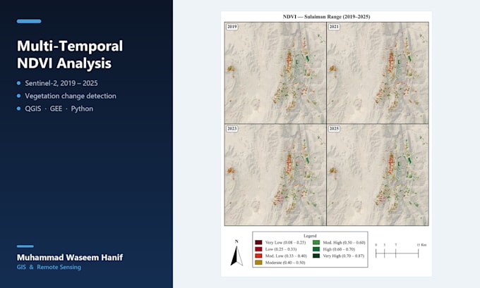
I create vegetation index maps and multi-date change detection analysis from satellite imagery.
What you get:
- NDVI, RVI or other vegetation index maps for your area of interest
- Change detection between two or more dates, with the change quantified rather than just coloured
- Print-ready map layouts, or raw GeoTIFF if you are doing your own analysis
- A short written interpretation of what the imagery actually shows
This is the exact method I used in my own research on forest cover change across four post-monsoon seasons, now written up for journal submission.
Imagery: Sentinel-2 (10m), Landsat 8/9 (30m), or your own supplied raster.
What I need from you: your area of interest (shapefile, KML, or a place name), the dates you care about, and what the output is for.
An honest note before you order: optical imagery is cloud-limited, so a specific date may not exist cleanly. Send me your dates first and I will check availability before you spend anything.
GIS Analyst Remote Sensing Satellite Imagery AI Automation Engineer
Languages