Browse categories
Explore
Fiverr Pro
English
$
USD
GeoAI Developer
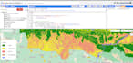
I offer high-quality geospatial solutions, including map creation with ArcGIS, QGIS, EnVi and advanced Google Earth Engine satellite image analysis. Services include:
With a focus on accuracy and customization, I tailor my services to meet your project needs, delivering outputs in your desired format. Ideal for urban planners, environmental researchers, and disaster resilience experts seeking actionable insights. Contact me today to turn your geospatial data into valuable intelligence!


Can you create high quality GIS maps?
Yes, I have an experience of more than 7 years in GIS mapping and analysis using ArcGIS, QGIS and Envi
Can you perform advance analysis using Google Earth Engine?
Yes, I am expert in remote sensing analysis using Google Earth engine(GEE) with more than 5 years of experience on satellite image classification and edge detection using ML modules inside GEE
Can you make prediction and forecasting in spatial data ( Especially in Satellite Imagery)?
Of course, Using collaboration of gdal and tensorflow, I can perform automatic image classification, feature extraction and advance level of mapping.


