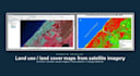
I will create a land use land cover map from satellite imagery

Y
youness_00
Y
youness_00
Youness

About this gig

Need to know what covers your land? I will create a clear land use / land cover map of your area from satellite or drone imagery, with area statistics for each class.


I'm a GIS analyst specialized in remote sensing. I have produced land cover and urban expansion maps for a regional coastal management project, using satellite imagery processed in ArcGIS.


What you get:

  • Imagery selection and preparation (Sentinel-2, Landsat or your own drone/satellite images)
  • Supervised classification adapted to your classes (urban, water, forest, crops, bare soil...)
  • Area table per class (Excel) and print-ready map (PDF/PNG)
  • Premium: comparison of 2 dates to show change (urban growth, deforestation...)

Useful for environmental studies, urban planning, agriculture, impact assessments and research. Maps in English or French. Send me your area and goal before ordering if you are not sure which package fits.

Get to know Youness

Youness

Esri certified

  • FromMorocco
  • Member sinceSep 2020
  • Last delivery6 years
  • Languages

    English, French
You can count on me to support you in your different projects steps and bring you a complete and professional solutions, based on 9 years of experience in GIS which allowed me to pass and earn the Esri Prfessional Certificate in mastering of ArcGIS Desktop.