Professional Google Earth Engine (GEE) expert providing satellite data and analysis services. Fast delivery, clean outputs, and full code included for academic and commercial projects.
1️ BASIC: Data Download ($30)
- Download key indices (NDVI, NDWI, NDBI) or raw imagery
- Up to 5 years of data for your region
- Cloud-masked, analysis-ready GeoTIFF/CSV files
- Quick data summary
- Delivery: 2 days | Revisions: 1
2️ STANDARD: Data + Analysis ($50)
- Everything in Basic PLUS
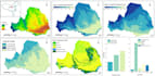
- Time-series charts and trend maps
- Custom visualizations for reports
- Statistical summaries
- Delivery: 3 days | Revisions: 2
3️ PREMIUM: Full Project Solutions ($150)
- Everything in Standard PLUS
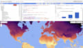
- Supervised classification, change detection, deep learning
- Complete, reusable GEE code (JavaScript/Python)
- Detailed methodology notes
- Unlimited time period
- Delivery: 7 days | Revisions: 3
To get started, provide:
- Your area of interest (coordinates/shapefile)
- Time period needed
- Specific data/analysis required
- Your chosen package