I will do land cover land use mapping

Z
zaddy84
Z
zaddy84
Zadock K

About this gig

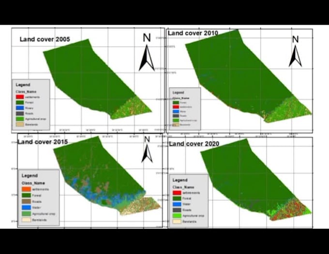
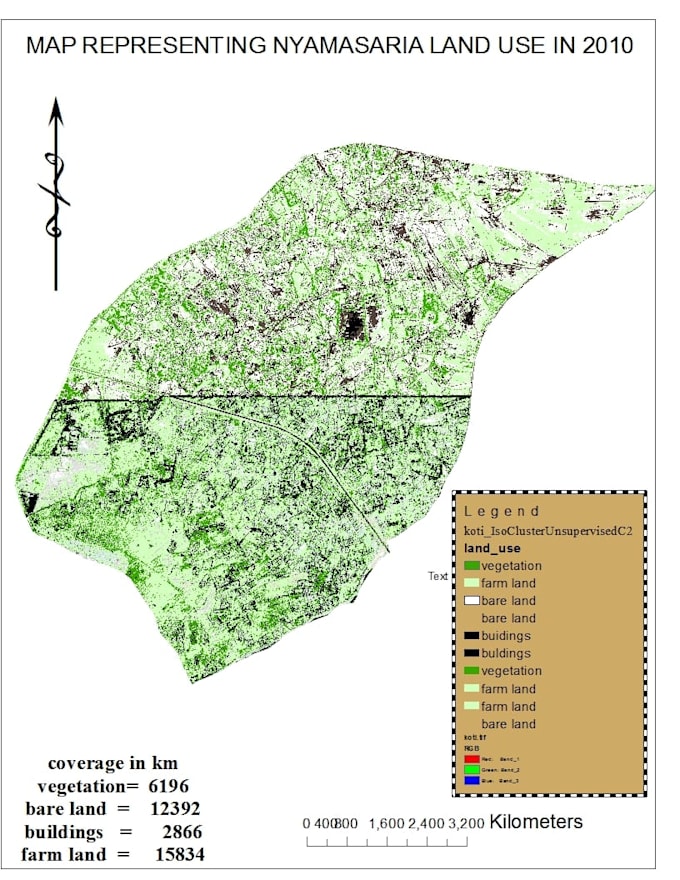
I will use QGIS, ArcGIS, Google earth API land use land cover mapping. The services will start from satellite image processing, basic land use mapping and Time series analysis.

Get to know Zadock K

Zadock K

I specialize in GIS, remote sensing and google earth engine

5.0(4)
  • FromKenya
  • Member sinceJun 2024
  • Avg. response time3 hours
  • Last delivery4 months
  • Languages

    English
Welcome to my GIS & RS , I excel in utilizing software tools such as ArcMap, QGIS, ArcGIS Pro, Python, and ArcGIS Online. Whether you're seeking expert services or looking to enhance your own skills, don't hesitate to reach out. The service I provide include 1 Digitization 2 Georeferencing 3 Hydrology analysis 4 Climate change analysis 5 Satellite image analysis 6 Vector raster analysis 7 Geospatial analysis 8 Developing web maps using Leaflet and OpenLayers. 9 spatial analysis in GIS, 10 creating GIS models, 11 web mapping 12 WebGIS, 13 ArcGIS online services