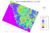
I will analyze satellite imagery and create lulc maps

Z
zia_rehman91
Z
zia_rehman91
Zia-ur-Rehman

About this gig

Professional Satellite Imagery & Land Use Land Cover Analysis

Do you need professional Land Use Land Cover (LULC) mapping or satellite imagery analysis for your research, environmental project, academic study, planning project, or geographical analysis?

I can help you create professional LULC maps and GIS-based satellite imagery analysis through ERDAS Imagine software for your study area.

I am a PhD in Geography with specialization in Geographic Information Systems (GIS) and Remote Sensing. My academic and professional background includes land-use/land-cover research, satellite remote sensing, GIS mapping, environmental analysis, and geographical research.

My Services Include:

  • Land Use / Land Cover (LULC) mapping
  • Satellite imagery analysis
  • Remote sensing analysis
  • Land-cover classification
  • Land-use change analysis
  • LULC change detection
  • NDVI analysis
  • Land Surface Temperature (LST) analysis
  • Environmental GIS analysis
  • Thematic mapping
  • Professional GIS map layouts
  • Spatial data visualization

Possible Applications:

  • Environmental studies
  • Geography research
  • Urban growth analysis
  • Agricultural studies
  • Coastal and wetland studies
  • Land-use planning
  • Climate and environment.


Delivery style preference

Please inform the freelancer of any preferences or concerns regarding the use of AI tools in the completion and/or delivery of your order.

Get to know Zia-ur-Rehman

Zia-ur-Rehman

Lecturer in Geography

  • FromPakistan
  • Member sinceOct 2026
  • Languages

    Urdu, English
I am a PhD-qualified Geography professional specializing in GIS and Remote Sensing with extensive experience in academia and government sectors. I have served as a Lecturer and Assistant Director for Environment, focusing on land-use evaluation and environmental monitoring. My expertise includes utilizing advanced geospatial techniques to analyze environmental changes and managing complex spatial databases.